| Sign In | Join Free | My carsrow.com |
|
| Sign In | Join Free | My carsrow.com |
|
| Categories | GIS Data Collector |
|---|---|
| Brand Name: | STONEX |
| Model Number: | M10 |
| Place of Origin: | China |
| MOQ: | 1 piece |
| Price: | $1000.00 |
| Payment Terms: | L/C, T/T |
| Supply Ability: | 1 ~ 30 day |
| Delivery Time: | 30 work day |
| Product name: | RTK receiver STONEX M10 |
| Channel: | 1408 Channels |
| Storage Temperature:: | -40℃ ~ +80℃ |
| GPS: | L1C/AL1C,L2C,L2P(Y),L5 |
| GLONASS: | L1,L2 |
| QNSS: | L1,L2,L5,L6 |
| GALILEO: | E1,E5a,E5b,E6 |
| Battery like: | 11 hours |
| Battery: | 4000mAh |
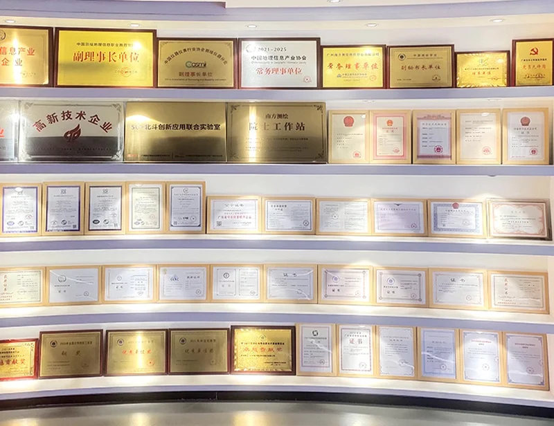
| Company Info. |
| Chengdu Jiebo Technology Co., Ltd. |
| Verified Supplier |
| View Contact Details |
| Product List |
CORS rtk gps price RTK receiver SunNav M10 GNSS System rover station cheap price
Description
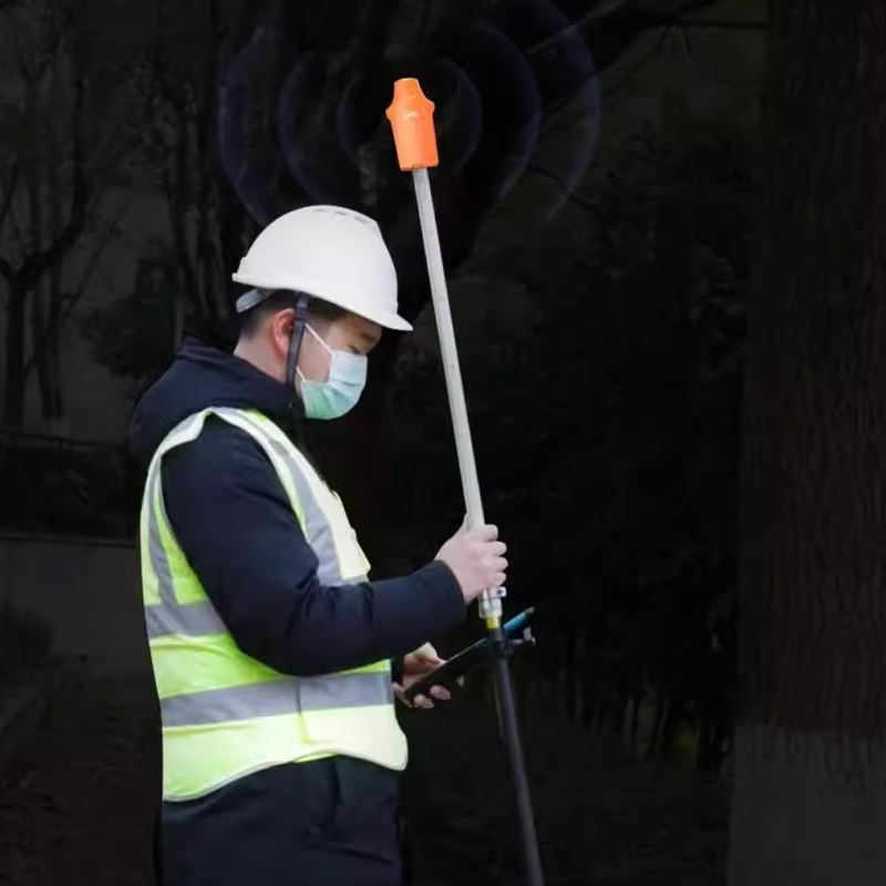
M10 is a lightweight, simple and practical high-precision full-constellation GNSS RTK receiver,
supporting five-satellites and sixteen-frequency, high-performance aluminumalloy body,
used with Android data collector, and can be used in engineering surveying, geological survey,
precision agriculture, and land survey, unmanned, geographic infor- mation,water survey, aerialphotogrammetry, etc..
Features
* Small size and high integration, the M10 inte- grate large-capacity battery, GNSS antenna,satellite positioning module,Bluetooth, etc.;
* Long battery life, low power consumption, built-in 4000mAh large-capacity battery, sup- porting more than 11 hours of battery life;
* High precision and low power consumption, using Beidou, GPS, GLONASS, Galileo, QZSS and other five- satellites sixteen frequencies, can ensure positioning accuracy in a variety of complex environments;
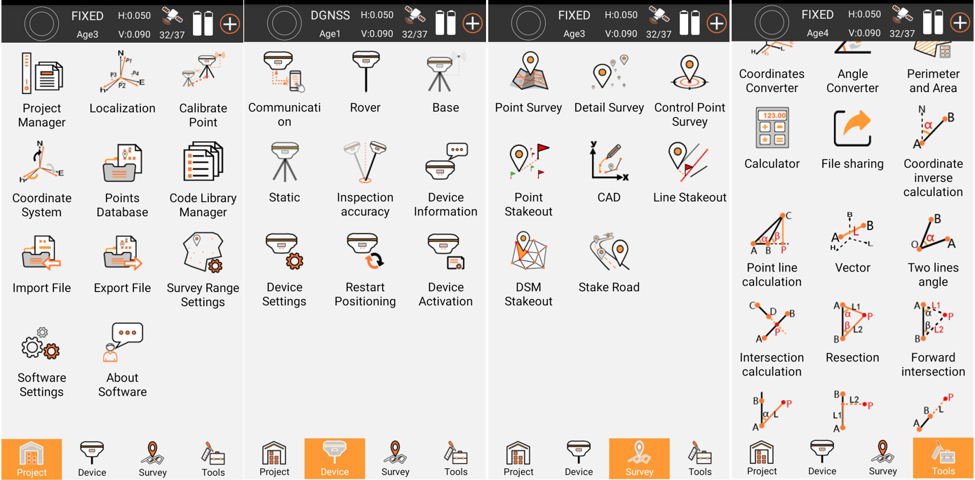
* The software adoptsthe standard versionmea- surement software or the flagship version mea- surement software, which has the functions of measurement, point placement, CAD stakeout, etc.;
* Adopt universal standardTYPE-C charging interface, support power bank charging, sup- port TYPE-C upgrade;
* Flexible use, can be held by hand or screwed directly to the centeringrod for measurement;
* Standard IP67 waterproof and dustproof design;
* The total weight of the deviceis 160g, which is smalland light, easy to carry;
* Built-in 4.0 Bluetooth module, support variousAndroid phone connections;
* The software supportsvarious CORS systems.
M10 CORS GNSS RTK Receiver GPS Land Surveying Instrument
| Product | eSA2 |
| GNSS Performance | |
| Channels | 1408 |
| Satellites tracking | · GPS: L1C/A, L2P(Y), L2C, L5 · GLONASS: L1, L2 · GALILEO: E1, E5a, E5b, E6 · BDS: B1I, B2I, B3I, B1C, B2a, B2b · QZSS: L1, L2, L5, L6 · SBAS:Support |
| Position accuracy | RTK: 0.01 m + 1 ppm CEP Single: 1.5m |
| Initialization time | ≤5 seconds (Typical) |
| Cold start | ≤30 seconds |
| Hot start | ≤3 seconds |
| Speed accuracy | ≤0.03 m/s |
| Electrical | |
| Battery | Built-in, Non-replaceable, Lithium Polymer Battery 7.4V / 1800mAh |
| Working time | ≥10 hours |
| Input voltage | 5V dc / 2A |
| Data Interface | |
| Bluetooth | Yes |
| Type-C port | 1 Type-C port |
| User Interface | |
| Button | Power button x1 |
| Indicator | Power indicator x1 Bluetooth indicator x1 Differential data indicator x1 Satellite indicator x1 |
| Physical | |
| Dimension | 118mm x 52mm x 36mm |
| Weight | ≤210 g |
| Environment | |
| Operating temperature | -20℃ ~ +75℃ |
| Storage temperature | -40℃ ~ +85℃ |
| Water/dust-proof | IP67 |
| Shock resistance | 1.6 m free drop |
| Humidity | 95% No condensation |

|