| Sign In | Join Free | My carsrow.com |
|
| Sign In | Join Free | My carsrow.com |
|
| Categories | Geophysical Survey Equipment |
|---|---|
| Brand Name: | RanCheng |
| Model Number: | RC-M300/500/1200/2000/3000-16D |
| Certification: | CE, ISO 9001:2000 |
| Place of Origin: | China |
| MOQ: | 1 |
| Price: | Negotiable |
| Payment Terms: | T/T, Western Union |
| Supply Ability: | 100sets per Month |
| Delivery Time: | 10-15 working days |
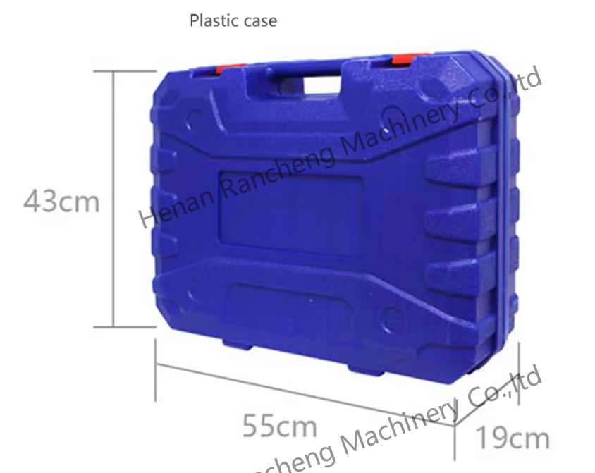
| Packaging Details: | Standard shipping |
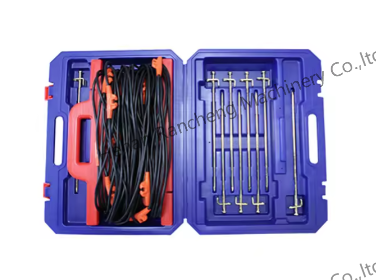
| Channel Input: | 16 channels input simultaneously, maximum electrode spacing 2.5m |
| Channel Options: | 1-14 |
| Depth Options: | 100/200/300/400/500/600/800/1200/2000/3000m |
| Scan Interval: | 10-80 |
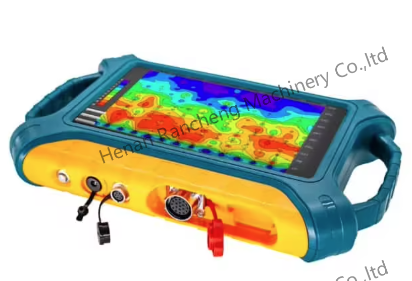
| Connections: | Serial port, Wifi, Bluetooth 4.0, USB (optional 4G) |
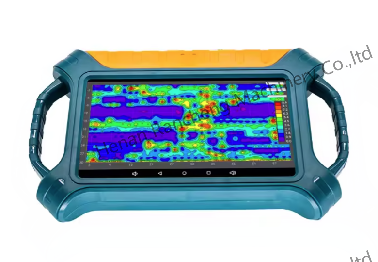
| Display: | 10.1-inch IPS wide-angle 178° visual touch screen (1024×600) |
| Company Info. |
| Henan Rancheng Machinery Co., Ltd. |
| Verified Supplier |
| View Contact Details |
| Product List |
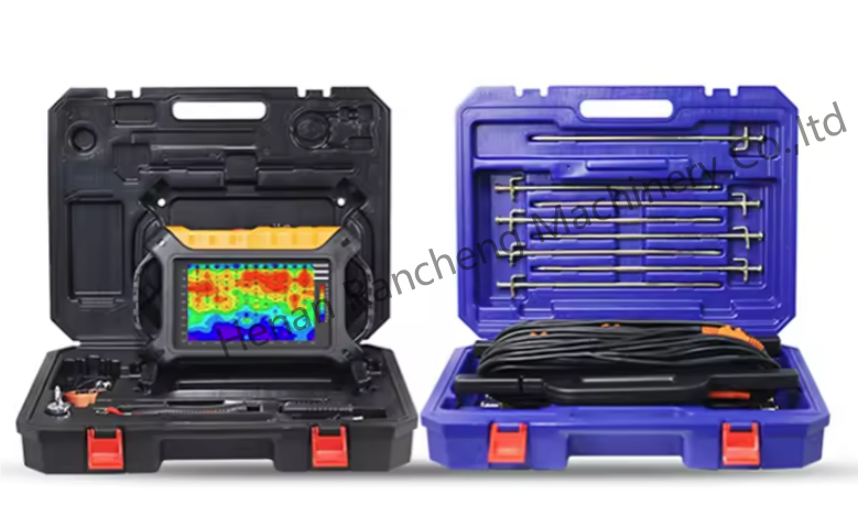
Automatic Imaging Geophysical Survey Equipment with Triple Screen Interoperability
Product Description:
The detection system is equipped with advanced anti-interference solutions. Through multiple protection mechanisms (such as frequency band optimization technology and intelligent digital signal processing), it can maintain excellent data stability and measurement accuracy even in urban areas with complex electromagnetic environments, industrial areas with strong interference, or remote areas with weak signals.
The equipment is equipped with intelligent analysis functions, which can generate high-definition detection maps in real time, intuitively display abnormal areas, and provide scientific basis for drilling positioning. In addition, the multi-language interactive interface design greatly improves the convenience of cross-border operations and meets the control needs of users in different regions around the world.
Features:
Ø 3D imaging: quickly make 2D.3D images with your phone or tablet
Ø Precise and intelligent:46 years of research and development history, accurate and reliable data.
Ø Simple and efficient:APP operation is simple and easy to understand, innovative measurement methods are 3-6 times faster than traditional methods,simple and ifficient
Ø Inexperienced people can learn the operation in 5 minute
Main advantages:
Automatic imaging:The 10.1" Android touch screen is intelligent in
real time into 2D, 3D and curved images.
Precise and stable:
The disadvantages of natural electromagnetic field sources, which
are inconsistent in size and change from time to time, are solved
and the accuracy is greatly improved.
Triple screen interoperability:
The instrument screen, mobile phone screen and computer screen are
interoperable.
| Versions | 300m-16D | 500m-16D | 1200m-16D | 2000m-16D | 3000m-16D |
| Max Depth (m) | ≤300 | ≤500 | ≤1200 | ≤2000 | ≤3000 |
| Channel Input | 16 channels input simultaneously, maximum electrode spacing 2.5m | ||||
| Channel Options | 1-14 | ||||
| Depth Options | Optional within the maximum depth, refer to 100/200/300/400/500/600/800/1200/2000/3000m | ||||
| Scan Interval | 10-80 | ||||
| Connections | Serial port, Wifi, Bluetooth 4.0, USB (optional 4G) | ||||
| Display | 10.1-inch IPS wide-angle 178° visual touch screen (1024×600) | ||||
| OS | Android 6.0.1 | ||||
| CPU | ARM Cortex-A7 8-core CPU 2.0Hz | ||||
| GPU | OpenGL ES 2.0 | ||||
| Core Features | Multiple options of depths, 2D/3D plotting, removable battery | ||||
| Sensing Mode | MN/TT | ||||
| Frequency Range (hz) | 1-8K | 0.01-6K | |||
| Filtering | Preset or intelligent frequency selection, analog + data filtering 1-16 times superposition optional | ||||
| Discrim. | 0.1mV±3% | 0.01mV±2% | |||
| Acquisition Time (s) | 60-3600 | 120-5400 | |||
| Battery | 800mA/H | ||||
| Console Weight | 1.85kg | ||||
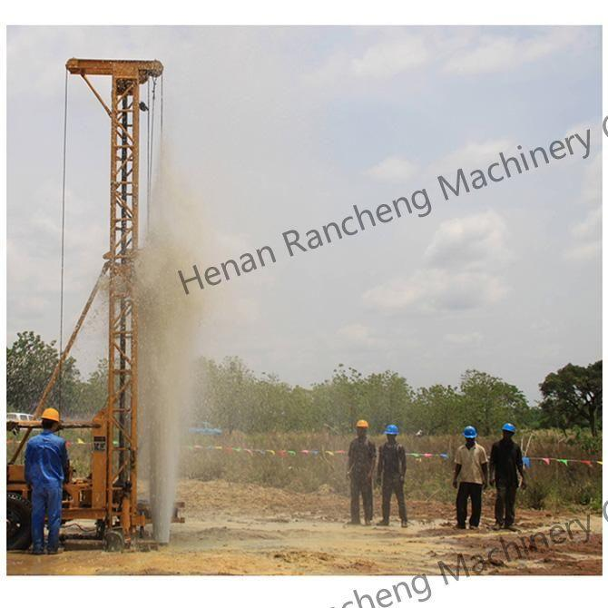
Underground water detector is a professional equipment used for hydrogeological exploration. By detecting underground electromagnetic waves or geological structures, the underground water detector can effectively determine key information such as the location, depth and amount of groundwater. This information provides scientific guidance for drilling and water extraction operations. The underground water detector improves the success rate of drilling, and reduces resource waste and cost investment.
Support and Services:
Is it difficult to operate?
---The device is simple to operate and can be used without any
experience.
There are related U disks with detailed information in the box.
Guide for After-sale Service
> 1-year guarantee-if using of the product is influenced due to
quality problem, you may receive guarantee of the product within 1
year after the date of purchase;
> Lifetime maintenance-lifetime maintenance service is
implemented on all factory series products. We offer maintenance of
machine which surpasses the maintenance period or has manual damage
with material and lab
delivery time :10-15days
standard exporting packing

|
