| Sign In | Join Free | My carsrow.com |
|
| Sign In | Join Free | My carsrow.com |
|
| Categories | Airborne Mapping Payload |
|---|---|
| Brand Name: | Geosun Navigation |
| Model Number: | GS-960 LiDAR Scanning System |
| Certification: | CE, ISO |
| Place of Origin: | China |
| MOQ: | 1 |
| Price: | Negotiation |
| Payment Terms: | T/T, Western Union, L/C, Credit Card |
| Supply Ability: | 30 SETS/Month |
| Delivery Time: | 20-30 works days |
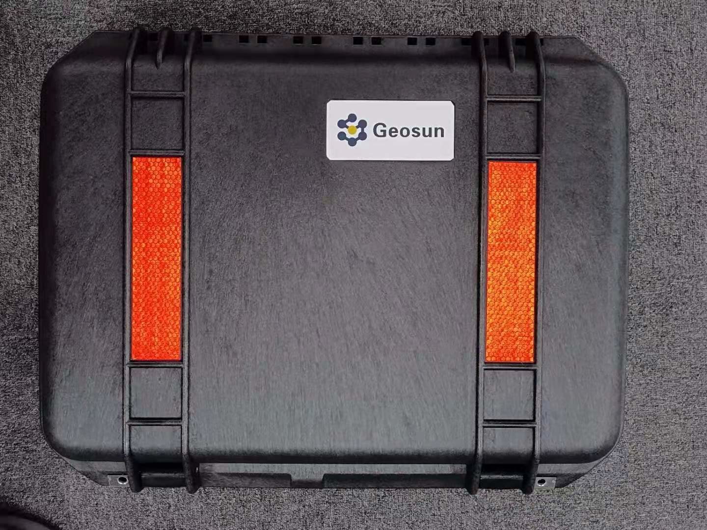
| Packaging Details: | Suit Case 520*420*230 mm |
| Name: | GS-960LiDAR Scanning System |
| Weight: | 1.6kg |
| Working Temperature: | -10℃~40℃ |
| Carrying Platform: | DJI M300/M350/Multi-Rotor/VTOL |
| Range Accuracy: | 5mm |
| Detection Range: | 750m |
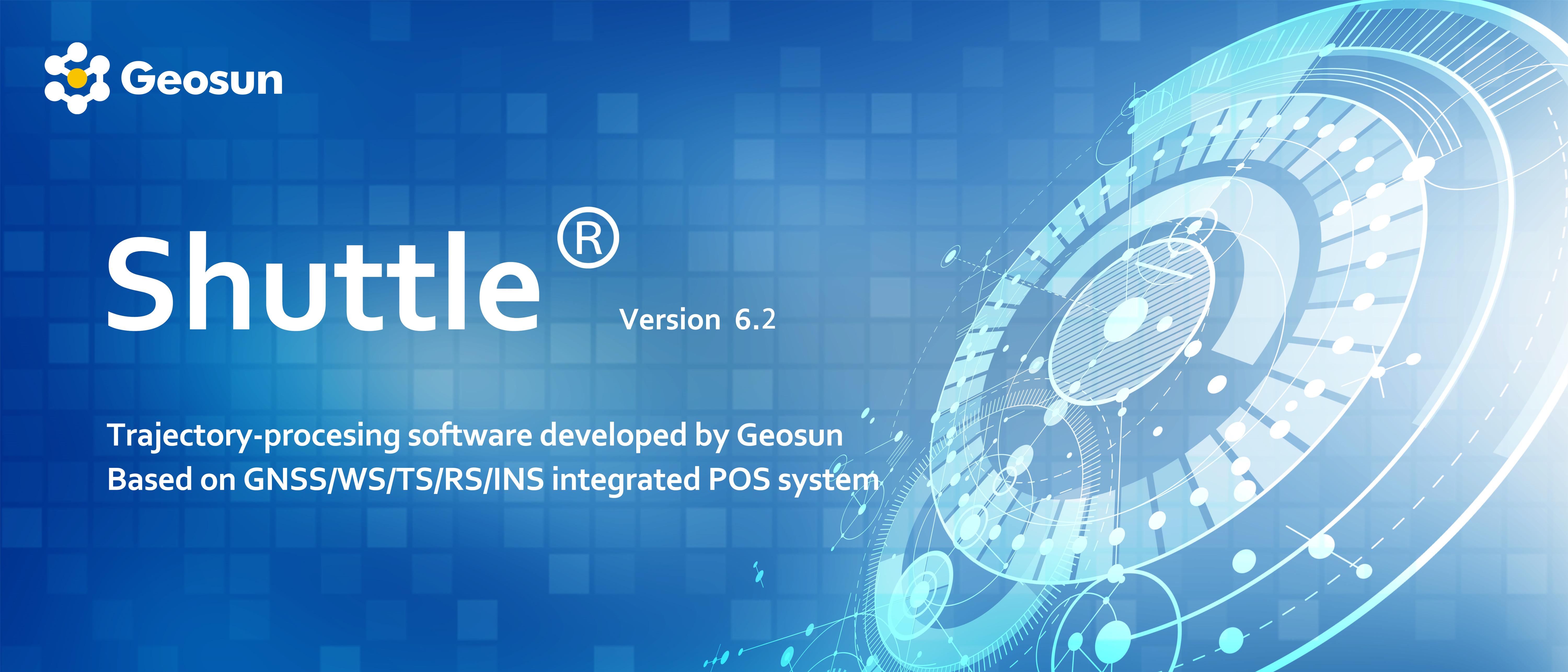
| Trajectory Software: | Shuttle |
| Point Cloud Software: | gAirHawk |
| Company Info. |
| Wuhan Geosun Navigation Technology Co., Ltd. |
| Verified Supplier |
| View Contact Details |
| Product List |
Long Range Laser Scanning System Supported Seven Echo Colored Point Cloud Free Trajectory Processing
The GS-960 is a cutting-edge high-precision UAV LiDAR scanning system developed by Geosun Navigation. Its integrated design combines surveying-grade LiDAR, a high-performance IMU, and photogrammetric cameras. With long-range capabilities, a lightweight structure, strong penetration, and high efficiency, this system is perfect for terrain surveying, power inspection, emergency mapping, and mining measurement. GS-960 LiDAR Solution.pdf
Application of LiDAR Scanning system
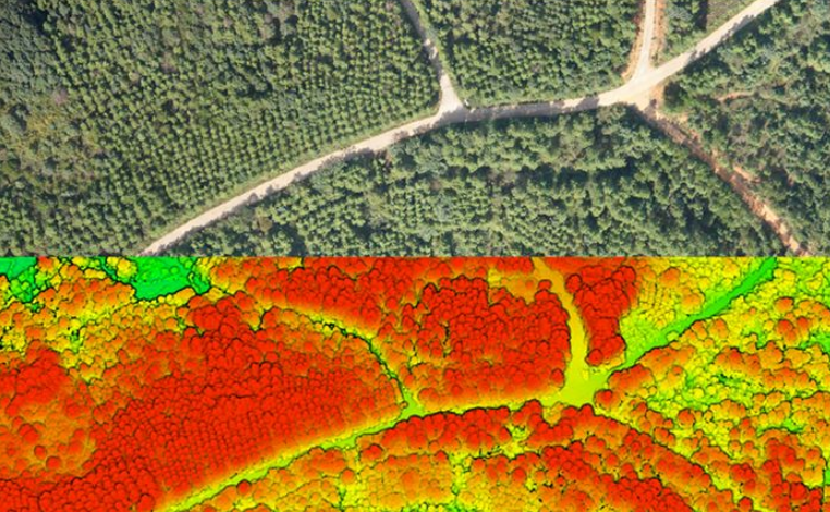
Forestry Survey
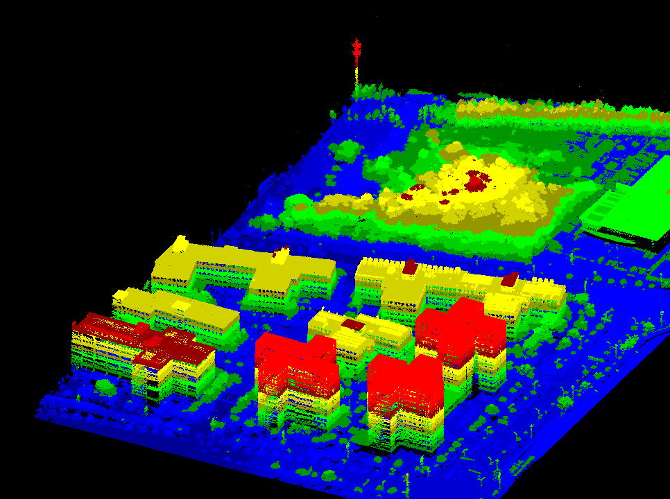
Smart City Construction

Terrain Mapping
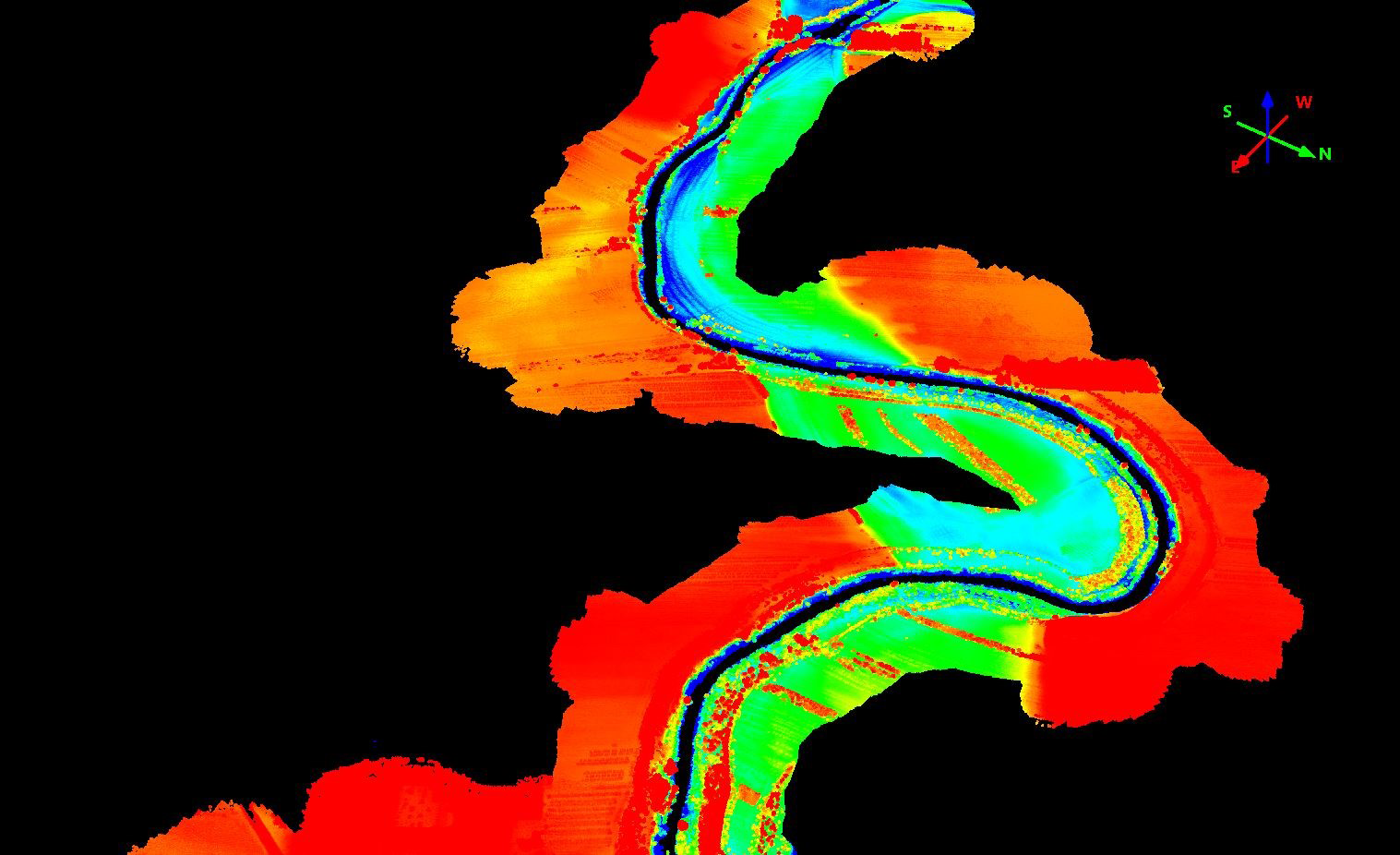
Water Resource Survey
Free trial software of UAV LiDAR Scanning System
Trial Software Information.pdf
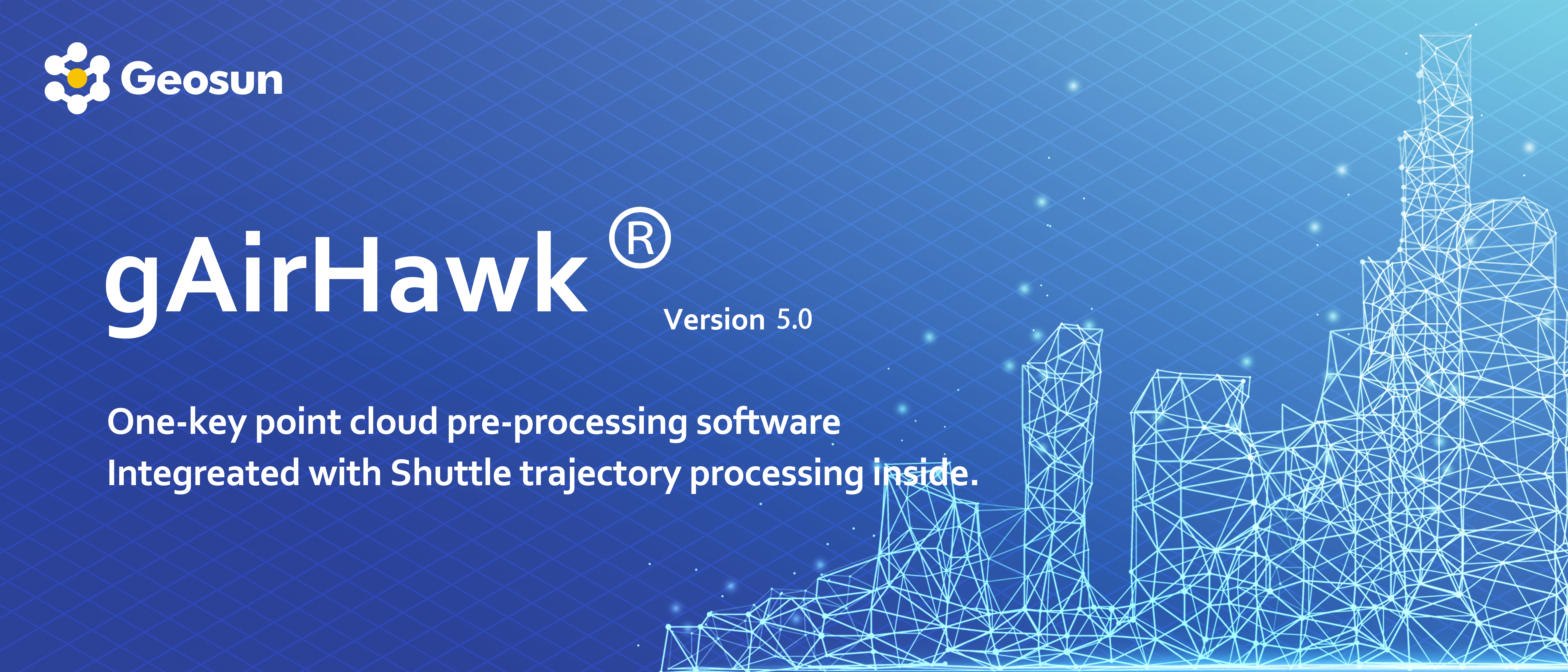
Point Cloud Pre-Processing Software Integrated With Trajectory
Processing----Geosun Self-developed gAirHawk 5.0
Key Features of gAirHawk 5.0 Software
1. Raw data: intelligently load
2. Four default coordinates
3. Point cloud Optimization
4. Start and stop calculation
Free trial test, achieve high precision
Specification of LiDAR Scanning System
| LiDAR Scanning System gAirHawk GS-960 | ||
| Item Name | System Parameters | |
Parameters | Weight | 1.6kg (45MP Camera) |
| Working temperature | -10℃~+40℃ | |
| Power range | 24V | |
| Consumption | 70 W | |
| Carrying Platform | DJI M300/M350/Multi-Rotor/VTOL | |
| Storage | 256GB | |
Lidar Unit | Measuring Range | 500m@20% Reflectivity; 1000m@80% Reflectivity |
| Laser class | 1535nm Class1 (IEC 60825-1:2014) | |
| Scan Rate | 300 lines per second | |
| Measuring accuracy | 5mm | |
| Max. Range | 750m | |
| Return | Unlimited | |
| Point Frequency | 100KHZ~550KHZ | |
| FOV | 80° | |
| POS Unit | Update frequency | 200HZ |
| Heading accuracy | 0.017° | |
| Pitch accuracy | 0.005° | |
| Rolling accuracy | 0.005° | |
| Position accuracy | Horizontal: 0.02m, Vertical: 0.03m | |
| GNSS signal type | GPSL1/L2/L5 GLONASSL1/L2 BDS B1/B2/B3 GAL E1/E5a/5b | |
| Model | gSpin 310 | |
| Pre-processing software | POS software | Output information: position, speed, attitude |
| Point cloud software | Output point cloud data format: LAS format, custom TXT format | |
| Camera (option) | Effective Pixel | 45 Mega Pixel |
| Trigger event | Distance or Time trigger | |
| FOV | 79° | |
Package of UAV LiDAR Scanning System
UAV LiDAR scanning system is packed in suit case with EVA material liner inside, then covered by a hard carton box. It is suitable for air shipment and sea shipment.

|
