| Sign In | Join Free | My carsrow.com |
|
| Sign In | Join Free | My carsrow.com |
|
| Categories | Point Cloud Processing Software |
|---|---|
| Brand Name: | Geosun |
| Model Number: | PointCloudCreater 2.0.46 |
| Certification: | Intellectual Property Right |
| Place of Origin: | China |
| MOQ: | 1 |
| Price: | Free |
| Payment Terms: | T/T, Western Union |
| Supply Ability: | No limitation |
| Delivery Time: | 1-3 Working Days Since Payment |
| Packaging Details: | None |
| Name: | PointCloudCreater 2.0.46 |
| Application 1: | Point clouds output |
| Application 2: | LAS file output |
| Function 3: | 3D data processing |
| Company Info. |
| Wuhan Geosun Navigation Technology Co., Ltd. |
| Verified Supplier |
| View Contact Details |
| Product List |
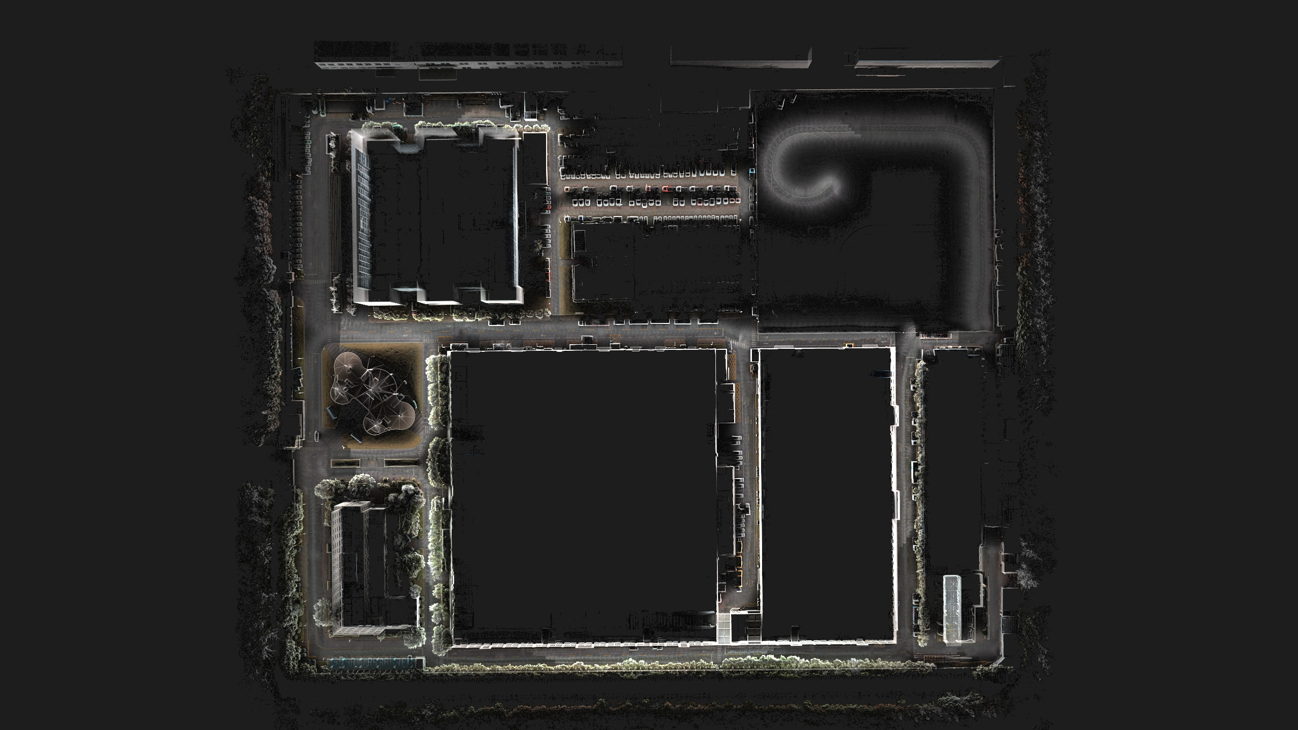
PointCloudCreater 2.0 Software Introduction
Integrated LiDAR Data Pre-Processing Software with Built-in Trajectory and Point Cloud Calculation
PointCloudCreater 2.0 is an advanced LiDAR data pre-processing software independently developed by Geosun Navigation. It integrates trajectory computation, point cloud generation, and optimization into a single streamlined platform, delivering high-precision and efficient results for a wide range of LiDAR applications.
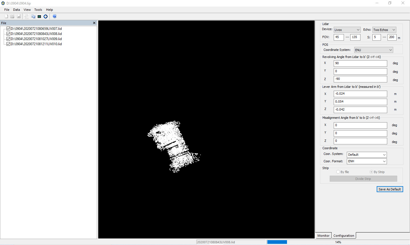
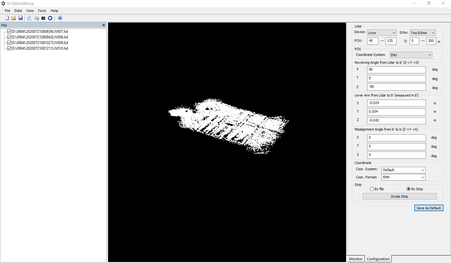
By decoding base station GNSS, mobile GNSS, IMU, and LiDAR data, the software calculates accurate POS (position, orientation, speed) information and generates colorized and optimized point clouds in LAS format.
System Capabilities
Automatic identification of raw data and hardware parameters
One-click project creation and full-process automation
Trajectory solution with centimeter-level accuracy
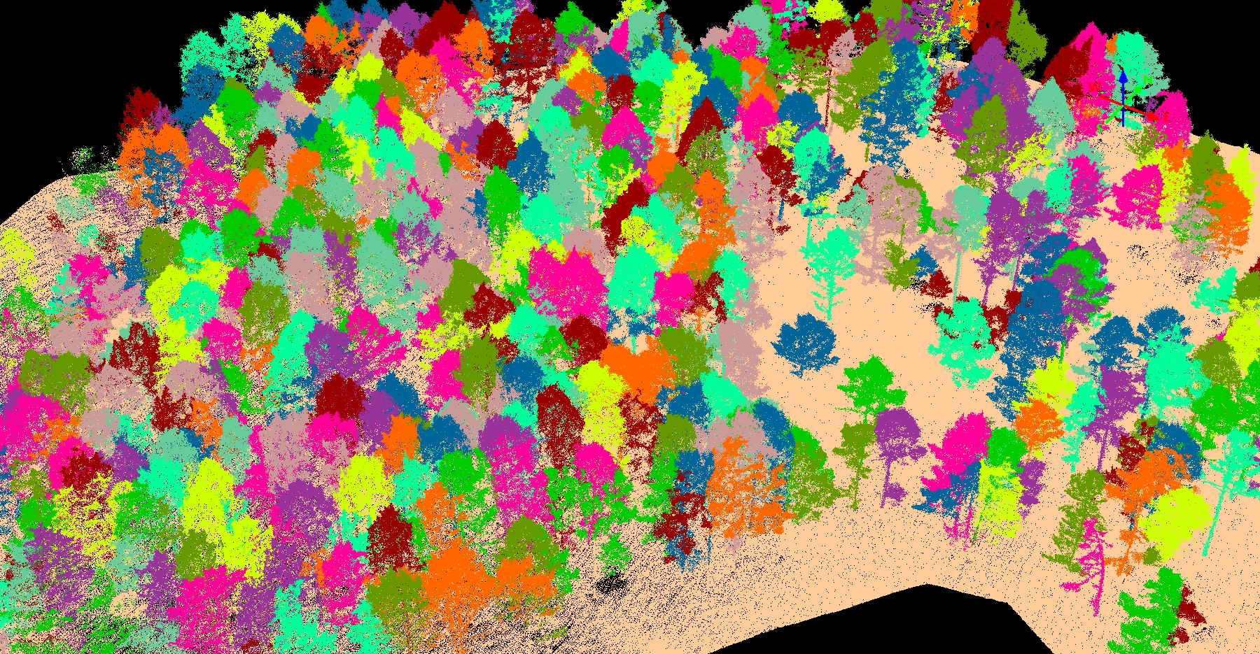
True color point cloud generation with strip-based organization
Real-time and post-processing support
Multi-coordinate system compatibility and transformation
High-efficiency output in industry-standard LAS format
Key Features
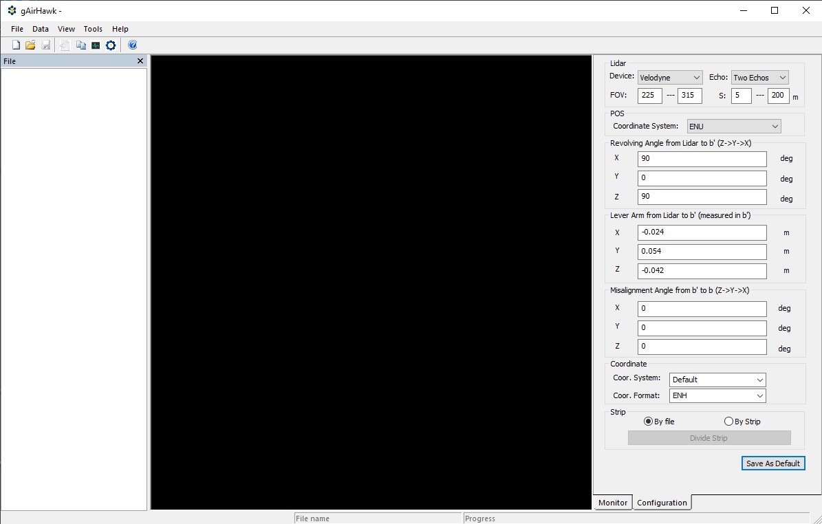
Easy to Operate
Intuitive interface with guided workflows; supports parameter
memory and import/export.
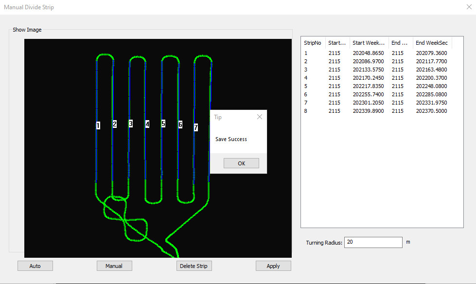
Strip Adjustment
Generates 2–3 cm precision point clouds with accurate geolocation
via POS data.
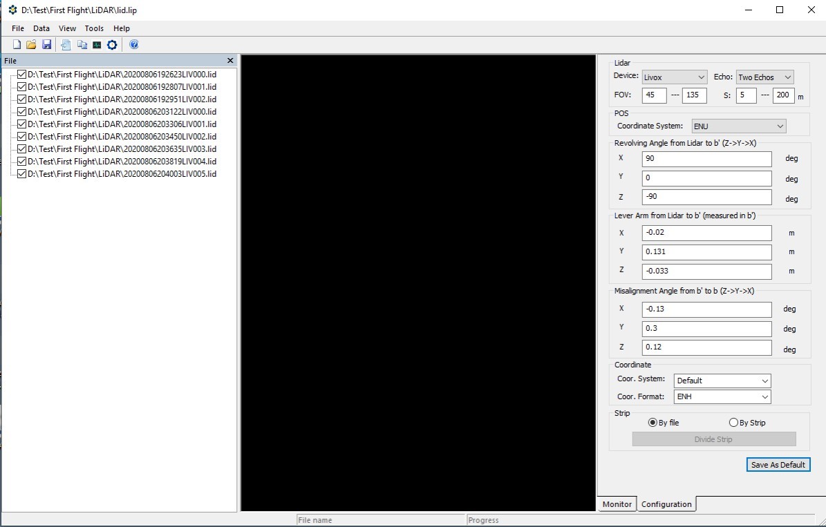
Powerful Data Calculation
Handles data from UAVs, helicopters, vehicles, and handheld
platforms.
Wide Sensor Compatibility
Supports popular LiDAR sensors such as Livox, Riegl, and Hesai.
Advanced Filtering & Processing
Includes distance filtering, GNSS time slicing, range filtering,
and laser line filtering.
Autonomous Coordinate Conversion
Automatically transforms point clouds to user-specified coordinate
systems.
High-Speed Processing
Rapid calculation and export of large-scale point cloud datasets in
LAS format.
Free Software for Testing-Document Overview:Trial Software Information
Click here to watch the video:The Operation of 4 8 Version of gAirhawk Software
Creat New Project and Operation
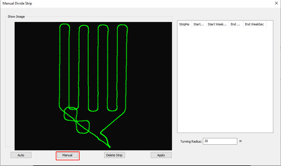
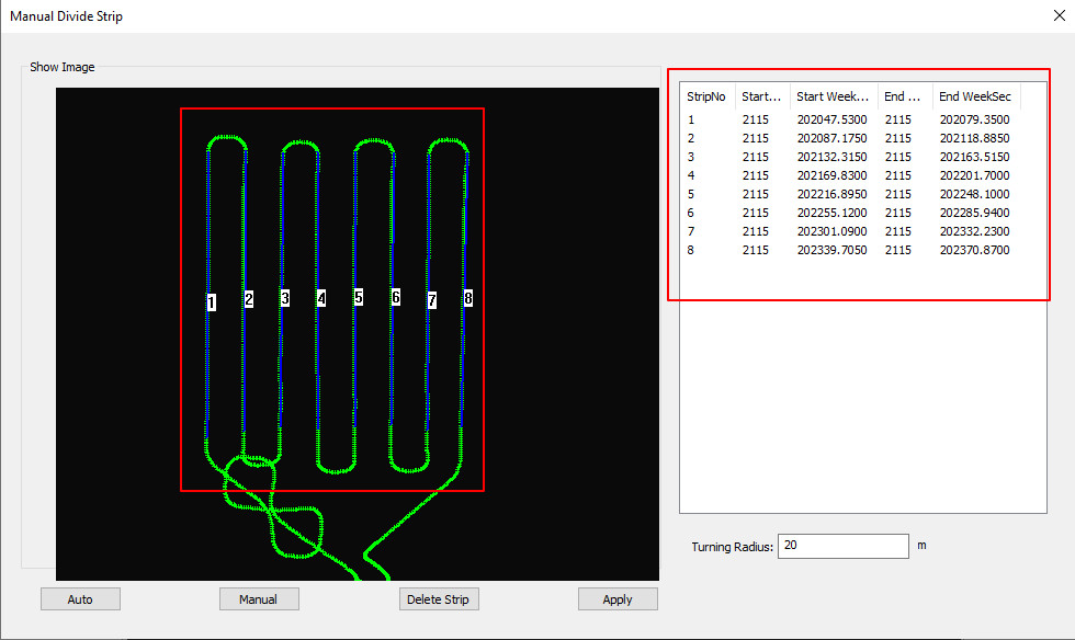
Divided by Strip
Lidar data process and point clouds output
Color point clouds


|
